openlayers 封装加载本地geojson数据 - vue3
Geojson数据是矢量数据,主要是点、线、面数据集合
Geojson数据获取:DataV.GeoAtlas地理小工具系列

实现代码如下:
import {ref,toRaw} from 'vue';
import { Vector as VectorLayer } from 'ol/layer.js';
import { Vector as VectorSource } from 'ol/source.js';
import { Style, Fill, Stroke, Circle as CircleStyle  } from 'ol/style';
import {Point, LineString, Polygon, MultiPoint, MultiLineString, MultiPolygon, Geometry} from 'ol/geom.js';
import { transform, fromLonLat, toLonLat } from 'ol/proj.js'
import Feature from 'ol/Feature.js';
import GeoJSON from 'ol/format/GeoJSON.js';
import Select  from 'ol/interaction/Select.js';
import Overlay from 'ol/Overlay';
import pointData from "../../../static/datas/point.json";// 本地点数据
import lineData from "../../../static/datas/line.json";// 本地线数据
import polygonData from "../../../static/datas/polygon.json";// 本地面数据
import multiPointData from "../../../static/datas/multiPoint.json";// 本地multipoint数据
import multiLineData from "../../../static/datas/multiLine.json";// 本地multiLine数据
import multiPolygonData from "../../../static/datas/multiPolygon.json";// 本地multiPolygon数据
import ccsData from "../../../static/datas/ccs.json";// 数据源
const vectorSource = ref(null);
// 创建图层
const vectorLayer = ref(null);// 添加
export const addBaseGeoJson = (map) =>{// 删除图层map.removeLayer(vectorLayer.value);// 创建要素数据源vectorSource.value = new VectorSource();// 创建要素图层vectorLayer.value = new VectorLayer();// 遍历本地数据pointData.features.forEach(function(element){const feature = new Feature();// 要素名称/类型const featurName = element.type;feature.setGeometryName(featurName);// 要素属性信息const properties = element.properties;// 要素图层类型const geomType = element.geometry.type;console.log("geomType",geomType)if("Point" == geomType){// 点数据// 要素数据图形 const pointGeom = element.geometry.coordinates// 转换坐标//const transformedCoords = transform([pointGeom[0],pointGeom[1]],'EPSG:4326', 'EPSG:3857');const transformedCoords = fromLonLat([pointGeom[0],pointGeom[1]]);// 添加数据const pointGeometry = new Point(transformedCoords);feature.setGeometry(pointGeometry);// 设置样式feature.setStyle(new Style({// 使用 CircleStyle 创建一个圆形的点image:new CircleStyle({// 点样式fill:new Fill({//color:"red",// 颜色color: 'rgba(255,0,0,0.4)',}),// 点周边样式stroke:new Stroke({color: '#3399CC',width: 1.25, }),radius:7,// 半径}),}));}else if("LineString" == geomType){// 线数据// 要素数据图形 const lineGeom = element.geometry.coordinates;// 转换坐标const transformedCoords = lineGeom.map((coord) => {return transform(coord, 'EPSG:4326','EPSG:3857');});// 创建线对象const lineGeometry = new LineString(transformedCoords);feature.setGeometry(lineGeometry);// 设置线特征样式(Style)feature.setStyle(new Style({stroke:new Stroke({color:"red",// 线的颜色width:7// 线宽带})}));}else if("Polygon" == geomType){// 面数据// 要素数据图形 const polygonGeom = element.geometry.coordinates;// 转换坐标const transformedCoords =  polygonGeom.map((item)=>{const coordResult = item.map((coord)=>{//return fromLonLat(coord, 'EPSG:4326','EPSG:3857');return fromLonLat(coord);});return coordResult;});// 创建面对象const polygonGeometry = new Polygon(transformedCoords);feature.setGeometry(polygonGeometry);// 设置多边形样式(Style)feature.setStyle(new Style({stroke:new Stroke({color:"yellow",// 多边形边界颜色width:2// 多边形边界宽度}),fill:new Fill({color:'rgba(0,0,255,0.5)'// 多边形填充颜色,这里设置为半透明颜色})}));}else if("MultiPoint" == geomType){// 点集合// 要素数据图形 const multiPointGeom = element.geometry.coordinates;// 转换坐标const transformedCoords = multiPointGeom.map((coord) => {return transform(coord, 'EPSG:4326','EPSG:3857');});// 创建MultiPoint对象const MultiPointGeometry = new MultiPoint(transformedCoords);feature.setGeometry(MultiPointGeometry);// 设置样式feature.setStyle(new Style({// 使用 CircleStyle 创建一个圆形的点image:new CircleStyle({// 点样式fill:new Fill({//color:"red",// 颜色color: 'rgba(255,0,0,0.4)',}),// 点周边样式stroke:new Stroke({color: '#3399CC',width: 1.25, }),radius:7,// 半径}),}));}else if("MultiLineString" == geomType){// 线集合// 要素数据图形 const multiLineGeom = element.geometry.coordinates;// 转换坐标const transformedCoords =  multiLineGeom.map((item)=>{const coordResult = item.map((coord)=>{//return fromLonLat(coord, 'EPSG:4326','EPSG:3857');return fromLonLat(coord);});return coordResult;});// 创建MultiLineString对象const MultiLineGeometry = new MultiLineString(transformedCoords);feature.setGeometry(MultiLineGeometry);// 设置多边形样式(Style)feature.setStyle(new Style({stroke:new Stroke({color:"green",// 多边形边界颜色width:2// 多边形边界宽度}),fill:new Fill({color:'rgba(0,0,255,0.5)'// 多边形填充颜色,这里设置为半透明颜色})}));}else if("MultiPolygon" == geomType){// 面集合// 要素数据图形 const multiPolygonGeom = element.geometry.coordinates;// 转换坐标const transformedCoords =  multiPolygonGeom.map((parentItem)=>{const parentCoordResult = parentItem.map((parentCoord)=>{const coordResult = parentCoord.map((coord)=>{//return fromLonLat(coord, 'EPSG:4326','EPSG:3857');return fromLonLat(coord);});return coordResult;});return parentCoordResult;});// 创建MultiPolygmon对象const multiPolygonGeometry = new MultiPolygon(transformedCoords);feature.setGeometry(multiPolygonGeometry);feature.setStyle(new Style({fill: new Fill({color: 'rgba(255, 0, 0, 1)'}),// 样式-边框stroke: new Stroke({color: '#0099ff',width: 3}),}));}// 点数据添加到数据源vectorSource.value.addFeature(feature);// 要素数据信息feature.setProperties(properties);});// 数据源添加到图层vectorLayer.value.setSource(vectorSource.value);// 将图层添加到地图上map.addLayer(vectorLayer.value);// 点选查看数据信息map.on('click', ev => {const pixel = ev.pixel   // 鼠标点击的位置,这个应该是像素const mousePoint = ev.coordinate  // 鼠标点击的坐标位置const feature = map.forEachFeatureAtPixel(pixel, (feature) => {return feature   // 查找出点击的哪个要素});if (feature) {  // 如果是点击了坐标点// 区域名称const properties = feature.getProperties();console.log("properties",properties);} else {console.log("没有要素数据");}})// 选中获取geojson数据/*if(vectorLayer.value != null){const featureLayer = toRaw(vectorLayer.value);// 创建选择交互const selectInteraction = new Select({layers:[featureLayer],});map.addInteraction(selectInteraction);// 监听选中要素的变化selectInteraction.on('select',(event) =>{// 获取被选中的要素const selectedFeatures = event.target.getFeatures();selectedFeatures.forEach(element => {//获取到选中要素的属性console.log("element",element.getProperties());});});}else{alert("没有要素图层!")}*/}/*** 添加点(坐标不一致位置会偏)不推荐使用* @param {*} map */export const addPoint = (map) =>{// 删除图层map.removeLayer(vectorLayer.value);// 加载本地数据vectorSource.value = new VectorSource({features: new GeoJSON().readFeatures(pointData),});vectorLayer.value = new VectorLayer({source: vectorSource.value,style:new Style({// 使用 CircleStyle 创建一个圆形的点image:new CircleStyle({// 点样式fill:new Fill({//color:"red",// 颜色color: 'rgba(255,0,0,0.4)',}),// 点周边样式stroke:new Stroke({color: '#3399CC',width: 1.25, }),radius:70,// 半径}),}),});map.addLayer(vectorLayer.value);
}
使用方法:
在**.vue引入
import {addBaseGeoJson} from "../js/baseGeojson.js";// 引入js// 使用
// 全图事件
const addJson = () => {addBaseGeoJson(map);
}
注意:本地数据放置在根目录新建static/datas/下

point.json数据格式:
{"type": "FeatureCollection","features": [{"type": "Feature","properties": {"name": "点1","region":"绿园区","content":"信息点1"},"geometry": {"type": "Point","coordinates": [125.362488, 43.916037]}},{"type": "Feature","properties": {"name": "点2","region":"绿园区","content":"信息点2"},"geometry": {"type": "Point","coordinates": [125.362488, 43.906037]}},{"type": "Feature","properties": {"name": "点3","region":"绿园区","content":"信息点3"},"geometry": {"type": "Point","coordinates": [125.363488, 43.936037]}}]
}
line.json数据格式:
{"type": "FeatureCollection","features": [{"type": "Feature","properties": {"name": "线1","region":"测试区1","content":"信息线1"},"geometry": {"type": "LineString","coordinates": [[125.363488, 43.936037],[125.362488, 43.906037]]}},{"type": "Feature","properties": {"name": "线2","region":"测试区2","content":"信息线2"},"geometry": {"type": "LineString","coordinates": [[125.44,43.95],[125.44,43.96]]}},{"type": "Feature","properties": {"name": "线3","region":"测试区1","content":"信息线1"},"geometry": {"type": "LineString","coordinates": [[125.34,43.95],[125.54,43.96]]}}]
}
polygon.json数据格式:
{"type": "FeatureCollection","features": [{"type": "Feature","properties": {"name": "面1","region":"测试区1","content":"信息面1"},"geometry": {"type": "Polygon","coordinates": [[[125.323488, 43.86037],[124.332488, 42.706037],[125.342401, 43.607037]]]}},{"type": "Feature","properties": {"name": "面2","region":"测试区2","content":"信息面2"},"geometry": {"type": "Polygon","coordinates": [[[125.44,43.95],[125.46,43.96],[125.24,42.96]]]}},{"type": "Feature","properties": {"name": "面3","region":"测试区1","content":"信息面1"},"geometry": {"type": "Polygon","coordinates": [[[125.34,43.95],[125.54,43.96],[125.64,43.90],[125.68,43.98]]]}}]
}
multiPoint.json数据格式:
{"type": "FeatureCollection","features": [{"type": "Feature","properties": {"name": "multiPoint点1","region":"绿园区","content":"信息点1"},"geometry": {"type": "MultiPoint","coordinates": [[125.362488, 43.916037],[125.352488, 43.936037]]}},{"type": "Feature","properties": {"name": "multiPoint点2","region":"绿园区","content":"信息点2"},"geometry": {"type": "MultiPoint","coordinates": [[125.362488, 43.906037],[125.372488, 43.946037]]}},{"type": "Feature","properties": {"name": "multiPoint点3","region":"绿园区","content":"信息点3"},"geometry": {"type": "MultiPoint","coordinates": [[125.563488, 43.976037],[125.373488, 43.946037]]}}]}multiLine.json数据格式:
{"type": "FeatureCollection","features": [{"type": "Feature","properties": {"name": "multiLine线1","region":"测试区1","content":"信息线1"},"geometry": {"type": "MultiLineString","coordinates": [[[125.363488, 43.936037], [125.362488, 43.906037]],[[125.263488, 43.736037], [125.242488, 43.706037]]]}},{"type": "Feature","properties": {"name": "multiLine线2","region":"测试区2","content":"信息线2"},"geometry": {"type": "MultiLineString","coordinates": [[[125.49,43.92],[125.45,43.96]],[[125.45,43.91],[125.44,43.96]]]}},{"type": "Feature","properties": {"name": "multiLine线3","region":"测试区1","content":"信息线1"},"geometry": {"type": "MultiLineString","coordinates": [[[125.38,43.95],[125.54,43.96]],[[125.34,43.92],[125.54,47.94]]]}}]
}
multiPolygon.json数据格式:
{"type": "FeatureCollection","features": [{"type": "Feature","properties": {"name": "multiPolygon面1","region":"测试区1","content":"信息面1"},"geometry": {"type": "MultiPolygon","coordinates": [[[[125.323488, 43.86037],[124.332488, 42.706037],[125.342401, 43.607037]]],[[[125.123488, 43.36037],[124.132488, 42.306037],[125.142401, 43.307037]]]]}},{"type": "Feature","properties": {"name": "multiPolygon面2","region":"测试区2","content":"信息面2"},"geometry": {"type": "MultiPolygon","coordinates": [[[[125.44,43.95],[125.46,43.96],[125.24,42.96]]],[[[125.46,43.95],[125.47,43.71],[125.28,42.56]]]]}},{"type": "Feature","properties": {"name": "multiPolygon面3","region":"测试区1","content":"信息面1"},"geometry": {"type": "MultiPolygon","coordinates": [[[[125.34,43.95],[125.54,43.96],[125.64,43.90],[125.68,43.98]]],[[[125.24,43.2],[125.34,43.94],[125.44,43.97],[125.58,43.99]]]]}}]
}
相关文章:

openlayers 封装加载本地geojson数据 - vue3
Geojson数据是矢量数据,主要是点、线、面数据集合 Geojson数据获取:DataV.GeoAtlas地理小工具系列 实现代码如下: import {ref,toRaw} from vue; import { Vector as VectorLayer } from ol/layer.js; import { Vector as VectorSource } fr…...

手机号码携号转网查询接口-在线手机号码携号转网查询-手机号码携号转网查询API
接口简介:通过手机号精准查询该号码转网前及转网后所归属运营商 可查询号码是否为虚拟手机号 可查询到号码归属地信息 高准确率,实时查询运营商数据库 多用于营销场景,如运营商业务办理、客户信息查询、携号转网、电话营销等 接口地址&#x…...

yolo目标检测和姿态识别和目标追踪
要检测摄像头画面中有多少人,人一排排坐着,像教室那样。由于摄像头高度和角度的原因,有的人会被遮挡。 yolo v5 首先需要下载yolo v5官方代码,可以克隆或下载主分支的代码,或者下载release中发布的。 简单说一下环境…...

Docker搭建开源Web云桌面操作系统Puter和DaedalOS
文章目录 Puter 操作系统说明基于 Docker 启动 Puter 操作系统拉取镜像运行容器基于 Docker-Compose 启动 Puter操作系统创建目录编写docker-compose.yml运行在本地直接运行puter操作系统puter界面截图puter个人使用总结构建自己的Puter镜像daedalos基于web的操作系统说明技术特…...

FAQ-为什么交换机发给服务器的日志显示的时间少8小时
问题描述 配置交换机向日志服务器发送日志,在交换机上面查看日志显示的时间比日志服务器显示的时间快8个小时 解决方案 根据公司全球化整改的要求,syslog默认发送的是UTC时间。 当前设备上配置了时区UTC8,因此,设备上显示的本地…...

[表达式]真假计算
题目描述 有一棵树,不一定是二叉树。 所有叶子节点都是 True 或者 False。 对于从上往下奇数层的非叶子节点是 and,偶数层非叶子节点为 or。 树上每个节点的值是所有孩子节点的值进行该节点的运算操作。 判断一棵树能否砍掉,最快的方法就是从…...

记录一次线上环境svchost.exe antimalware service executable 进程占用CPU过高问题
博主介绍: 大家好,我是想成为Super的Yuperman,互联网宇宙厂经验,17年医疗健康行业的码拉松奔跑者,曾担任技术专家、架构师、研发总监负责和主导多个应用架构。 技术范围: 目前专注java体系,有多…...
Docker 部署 EMQX 一分钟极速部署
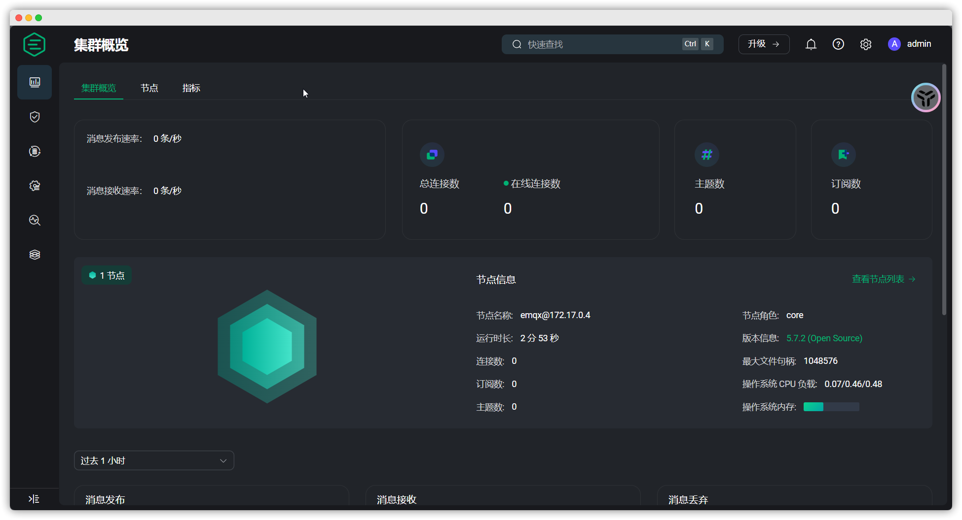
部署 EMQX ( Docker ) [Step 1] : 拉取 EMQX 镜像 docker pull emqx/emqx:latest[Step 2] : 创建目录 ➡️ 创建容器 ➡️ 拷贝文件 ➡️ 授权文件 ➡️ 删除容器 # 创建目录 mkdir -p /data/emqx/{etc,data,log}# 创建容器 docker run -d --name emqx -p 1883:1883 -p 1808…...

STL-常用容器-list
1list基本概念 **功能:**将数据进行链式存储 链表(list)是一种物理存储单元上非连续的存储结构,数据元素的逻辑顺序是通过链表中的指针链接实现的 链表的组成:链表由一系列结点组成 结点的组成:一个是存储…...

Lambda 架构
Lambda架构是一种用于构建可扩展、容错和实时数据处理系统的架构模式。 它由三个主要部分组成:批处理层(Batch Layer)、实时层(Speed Layer)和服务层(Serving Layer)。 Lambda架构旨在结合批处…...
Windows电脑设置网络唤醒(Wake-on-LAN)
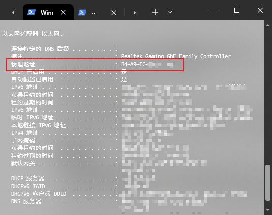
1. 启用 Windows 电脑的 Wake-on-LAN 功能 首先,你需要确保你的 Windows 电脑支持并启用了 Wake-on-LAN: BIOS/UEFI 设置(具体看自己电脑主板如何设置): 启动 Windows 电脑,进入 BIOS/UEFI 设置。找到网络适配器相关的设置,启用 …...

前端项目构建流程
1. 需求分析 目标:明确项目目标、核心功能和用户需求。 产品需求讨论: 与产品经理、客户、业务部门讨论项目的需求和目标,理解产品的功能、业务流程以及用户需求。定义用户角色(Persona),明确不同用户的功…...

支持国密算法的数字证书-国密SSL证书详解
在互联网中,数字证书作为标志通讯各方身份信息的数字认证而存在,常见的数字证书大都采用国际算法,比如RSA算法、ECC算法、SHA2算法等。随着我国加强网络安全技术自主可控的大趋势,也出现了支持国密算法的数字证书-国密SSL证书。那…...

【EndNote使用教程】创建文献库、导入文献、文献分类
1、创建文献库 打开“EndNote”,点击“文件”,点击“新建”,选择保存文件路径。 2、导入文献 (1)可以选择导入电脑上的PDF文件,如下图所示。 (2) 也可以选择直接在浏览器网页上面直…...

双十一电容笔选哪个好?!西圣、益博思、吉玛仕电容笔实测对比!
当数码测评博主几年年,我也实测过不下10款电容笔了,对电容笔这个品类也算是半个内行人了。提到电容笔,在平替品牌的追逐中,西圣、益博思、吉玛仕这三款作为国货黑马一直备受瞩目,综合各大电商平台的销量榜、好评口碑榜…...

房地产网络安全:主要风险及缓解建议
房地产行业已开始数字化转型,因此极易受到网络犯罪的攻击。潜在风险的清单很长:从客户敏感信息的数据泄露到勒索软件攻击,网络犯罪分子将房地产公司视为其所携带的所有类型敏感信息的高价值目标。 在本文中,我们将探讨房地产领域…...
玩转大模型的第一步——提示词(Prompt)工程【抛砖篇】
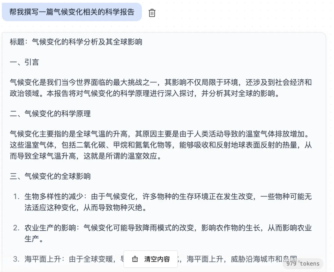
前言 AI大模型提示词工程,又名 LLM prompts Project,指的是在使用大型语言模型(如OpenAI的GPT系列)时,用于引导模型生成特定响应的输入,是在使用AI大模型过程中非常重要的一个环节,是模型生成文…...

火山引擎数据飞轮线上研讨会即将开启,助力消费品牌双十一造爆款
随着双十一的临近,各大品牌方的备战工作已进入紧张而有序的倒计时阶段。这场持续十多年的电商大促,对消费者来说是购物狂欢节,对各大品牌方来说,则是更是品牌实力与策略的比拼。面对日益激烈的市场竞争,如何更好地撬动…...

【python实战】利用代理ip爬取Alibaba海外版数据
引言 在跨境电商的业务场景中,数据采集是分析市场、了解竞争对手以及优化经营策略的重要环节。然而,随着越来越多企业依赖数据驱动决策,许多跨境电商平台为了保护自身数据,采取了更严格的防护措施。这些平台通过屏蔽大陆IP地址或部…...
--- 枚举macOS下的窗口和屏幕列表,并获取名称缩略图等信息)
FFMPEG录屏(20)--- 枚举macOS下的窗口和屏幕列表,并获取名称缩略图等信息
在 macOS 下获取可屏幕共享的窗口和屏幕 在 macOS 下,我们可以通过使用 Core Graphics 和 Cocoa 框架来获取当前系统中可屏幕共享的窗口和屏幕信息。本文将详细介绍如何获取窗口和屏幕的 ID、标题、坐标、进程图标和缩略图等信息。 前提条件 在开始之前ÿ…...
JavaSec-RCE
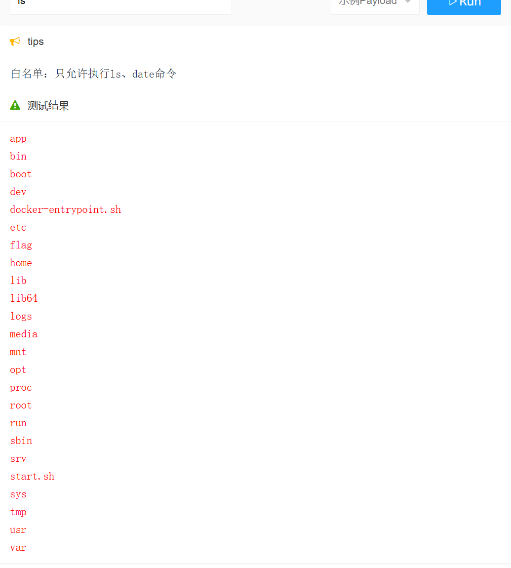
简介 RCE(Remote Code Execution),可以分为:命令注入(Command Injection)、代码注入(Code Injection) 代码注入 1.漏洞场景:Groovy代码注入 Groovy是一种基于JVM的动态语言,语法简洁,支持闭包、动态类型和Java互操作性,…...
。】2022-5-15)
【根据当天日期输出明天的日期(需对闰年做判定)。】2022-5-15
缘由根据当天日期输出明天的日期(需对闰年做判定)。日期类型结构体如下: struct data{ int year; int month; int day;};-编程语言-CSDN问答 struct mdata{ int year; int month; int day; }mdata; int 天数(int year, int month) {switch (month){case 1: case 3:…...
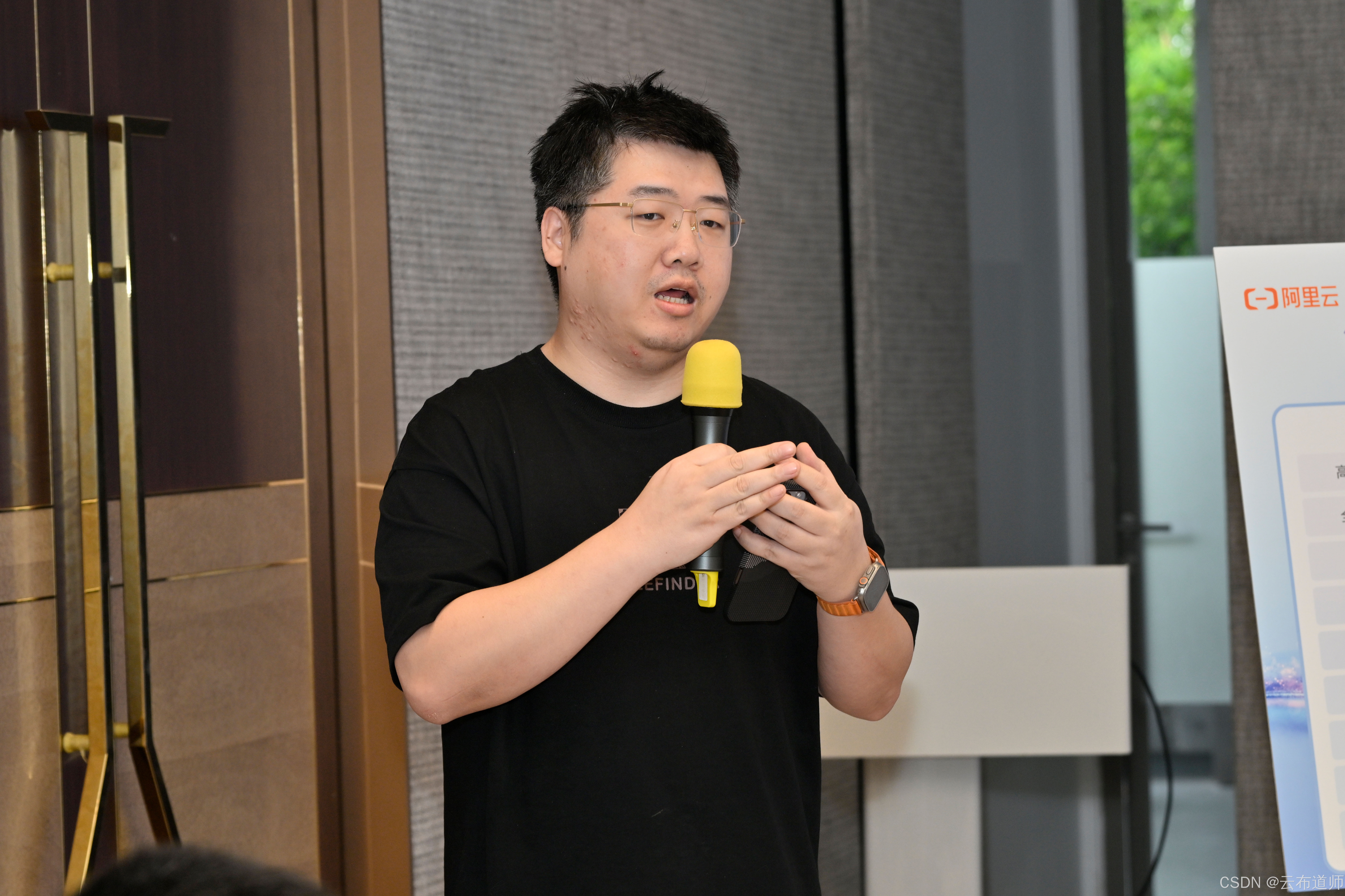
云启出海,智联未来|阿里云网络「企业出海」系列客户沙龙上海站圆满落地
借阿里云中企出海大会的东风,以**「云启出海,智联未来|打造安全可靠的出海云网络引擎」为主题的阿里云企业出海客户沙龙云网络&安全专场于5.28日下午在上海顺利举办,现场吸引了来自携程、小红书、米哈游、哔哩哔哩、波克城市、…...
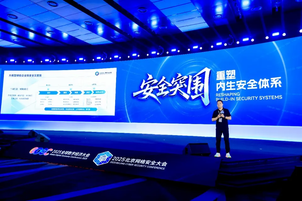
BCS 2025|百度副总裁陈洋:智能体在安全领域的应用实践
6月5日,2025全球数字经济大会数字安全主论坛暨北京网络安全大会在国家会议中心隆重开幕。百度副总裁陈洋受邀出席,并作《智能体在安全领域的应用实践》主题演讲,分享了在智能体在安全领域的突破性实践。他指出,百度通过将安全能力…...
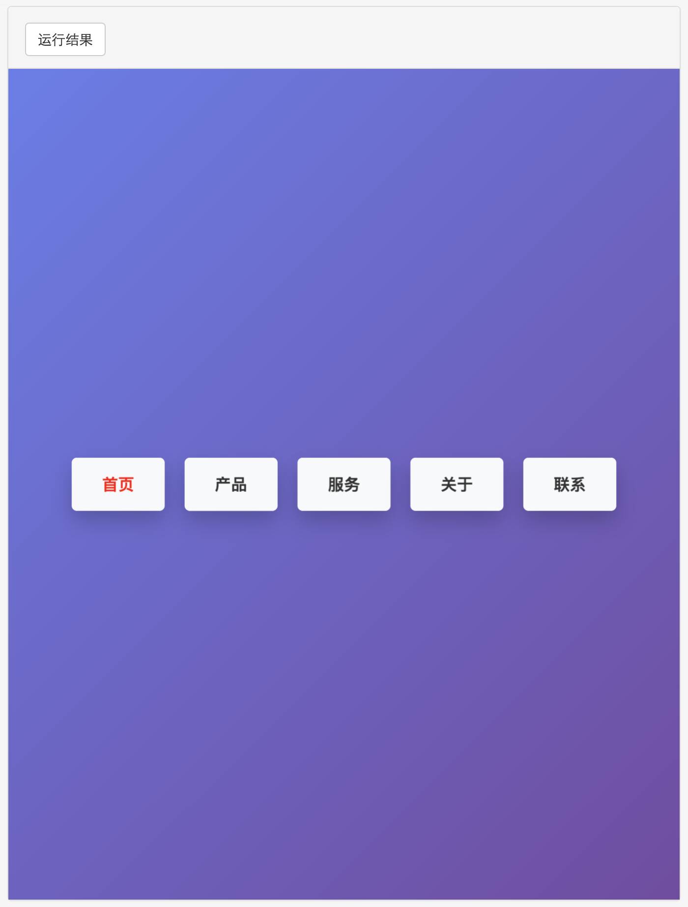
多种风格导航菜单 HTML 实现(附源码)
下面我将为您展示 6 种不同风格的导航菜单实现,每种都包含完整 HTML、CSS 和 JavaScript 代码。 1. 简约水平导航栏 <!DOCTYPE html> <html lang"zh-CN"> <head><meta charset"UTF-8"><meta name"viewport&qu…...

【笔记】WSL 中 Rust 安装与测试完整记录
#工作记录 WSL 中 Rust 安装与测试完整记录 1. 运行环境 系统:Ubuntu 24.04 LTS (WSL2)架构:x86_64 (GNU/Linux)Rust 版本:rustc 1.87.0 (2025-05-09)Cargo 版本:cargo 1.87.0 (2025-05-06) 2. 安装 Rust 2.1 使用 Rust 官方安…...
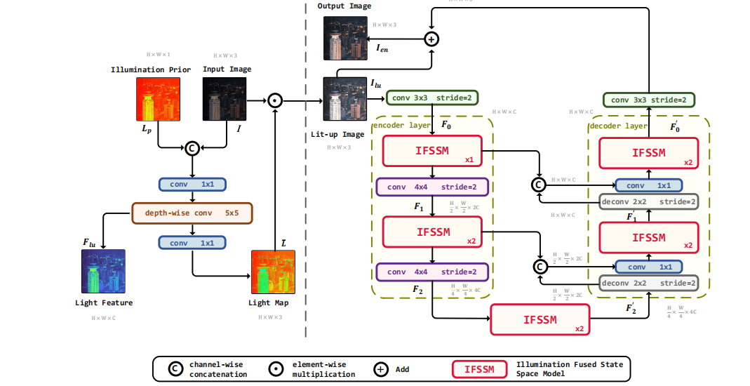
深度学习水论文:mamba+图像增强
🧀当前视觉领域对高效长序列建模需求激增,对Mamba图像增强这方向的研究自然也逐渐火热。原因在于其高效长程建模,以及动态计算优势,在图像质量提升和细节恢复方面有难以替代的作用。 🧀因此短时间内,就有不…...
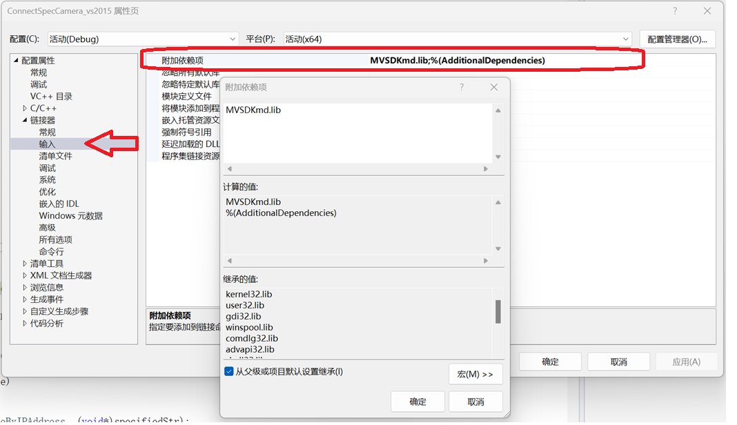
C/C++ 中附加包含目录、附加库目录与附加依赖项详解
在 C/C 编程的编译和链接过程中,附加包含目录、附加库目录和附加依赖项是三个至关重要的设置,它们相互配合,确保程序能够正确引用外部资源并顺利构建。虽然在学习过程中,这些概念容易让人混淆,但深入理解它们的作用和联…...

Vue ③-生命周期 || 脚手架
生命周期 思考:什么时候可以发送初始化渲染请求?(越早越好) 什么时候可以开始操作dom?(至少dom得渲染出来) Vue生命周期: 一个Vue实例从 创建 到 销毁 的整个过程。 生命周期四个…...

Vue 模板语句的数据来源
🧩 Vue 模板语句的数据来源:全方位解析 Vue 模板(<template> 部分)中的表达式、指令绑定(如 v-bind, v-on)和插值({{ }})都在一个特定的作用域内求值。这个作用域由当前 组件…...
